Marki3 said:
That is a great site for trip planning. How did you download the images from the page? I can only save as a PNG image which I don't have any programs that will enable me to manipulate the image. Thanks.
What OS? I used "Paint" which came with Windows. But if you want something more powerful, check out
Gimp.
jadnashuanh said:
The spacing, and the fact you can regain some of the energy used to go up a hill on the other side can make them almost disappear...but, not if you're almost at the end of the SOC while trying to go up one. The magic is to understand this, and to avoid it!
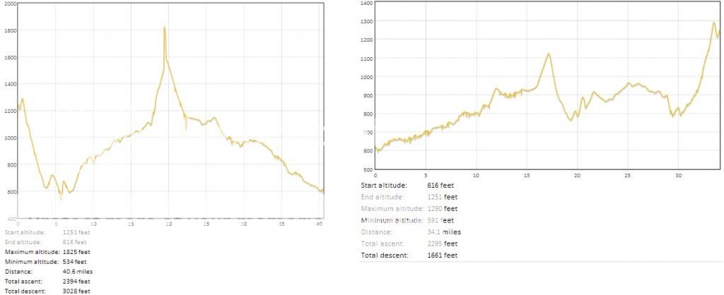
Yes, it takes practice - and I'm still learning. Funny thing is on the first leg when I hit that big hill early on, my predicted battery mileage quickly dumps down to 44 miles, but then it stays at 44 miles for the rest of the trip which is net downhill
")
. Heading home, which nets uphill, I just have to watch my speed. Staying around 65 on the steep uphill parts is usually enough to stretch my battery for the full ride.